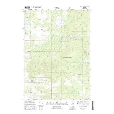
2017 Map of Crystal Valley
USGS Topo · Published 2017About this map
The Crystal Valley settlement serves as the southern anchor for this portion of the Manistee National Forest, where the landscape transitions from managed timberland to small rural hubs. To the north, the small community of Fern sits near the intersection of S Custer Rd and E Anthony Rd, illustrating the dispersed residential patterns typical of western Michigan's forest edges. This area is defined by a dense network of inland waters, including Eden Lake, Pleiness Lake, and Stewart Lake, which feed the drainages of the N Br Pentwater River. Genealogists will find the local history preserved at Mount Malissa Cem near the valley and Eden Cem to the northwest. The map documents a rugged interior crisscrossed by forest service roads like Fire Ln 5314, showing how the boundary between Mason Co and Oceana Co cuts through a region of complex hydrology and seasonal wetlands.
Find a feature on this map
55 named features on this map. Tap any name to fly to it.
Don’t see what you’re looking for? This feature index may not catch every label — zoom into the map to look around manually.
Map Details
Editions of this 2017 Crystal Valley Map
This is the sole edition of this map. No revisions or reprints were ever made.
Other maps of this area

1931 · Custer NW
USGS Topo · 1:31,680

1931 · Custer SW
USGS Topo · 1:31,680

1931 · Custer NE
USGS Topo · 1:31,680

1931 · Walkerville NE
USGS Topo · 1:31,680

1931 · Hart NE
USGS Topo · 1:31,680

1931 · Walkerville NW
USGS Topo · 1:31,680

1931 · Custer SE
USGS Topo · 1:31,680

1932 · Ludington NE
USGS Topo · 1:31,680

1932 · Ludington SE
USGS Topo · 1:31,680

1954 · Milwaukee
USGS Topo · 1:250,000