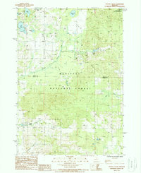
1987 Map of Crystal Valley
USGS Topo · Published 1988About this map
Crystal Valley serves as a primary settlement hub in this Michigan landscape, situated where Crystal Creek and Cleveland Creek converge. The terrain is defined by the dense woodlands of the Manistee National Forest, which covers a significant portion of the quadrangle across both Mason and Oceana counties. A distinctive network of historical transport is visible through the Old RR Grade that winds through the forest, marking the legacy of the region's earlier timber industry.
Find a feature on this map
25 named features on this map. Tap any name to fly to it.
Don’t see what you’re looking for? This feature index may not catch every label — zoom into the map to look around manually.
Map Details
Editions of this 1987 Crystal Valley Map
This is the sole edition of this map. No revisions or reprints were ever made.
Other maps of this area

1931 · Custer NW
USGS Topo · 1:31,680

1931 · Custer SW
USGS Topo · 1:31,680

1931 · Custer NE
USGS Topo · 1:31,680

1931 · Walkerville NE
USGS Topo · 1:31,680

1931 · Hart NE
USGS Topo · 1:31,680

1931 · Walkerville NW
USGS Topo · 1:31,680

1931 · Custer SE
USGS Topo · 1:31,680

1932 · Ludington NE
USGS Topo · 1:31,680

1932 · Ludington SE
USGS Topo · 1:31,680

1954 · Milwaukee
USGS Topo · 1:250,000