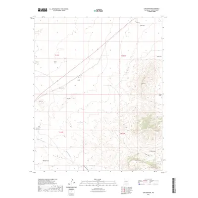
2023 Map of Cub Mountain
USGS Topo · Published 2023About this map
Cub Mountain rises as a central landmark in this high-altitude landscape of Lincoln County, where dramatic elevation changes define the local geography. The settlement of Polly sits north of the Polly Hills, serving as a focal point in a region dominated by a complex network of canyons and draws. Water sources are critical features of this arid terrain, evidenced by the presence of Rattlesnake Spring, Cub Mountain Spring, and Shady Spring, which likely supported early ranching or travel through the area. The map illustrates a transition from the lower elevations of Cottonwood Creek and Rim Rock Canyon to the prominent peaks of Chaves Mountain and The Hogback. The inclusion of Cripple Creek Rd and various canyons like Tanner Canyon provides insight into the historical accessibility and drainage patterns of this New Mexico backcountry.
Find a feature on this map
28 named features on this map. Tap any name to fly to it.
Don’t see what you’re looking for? This feature index may not catch every label — zoom into the map to look around manually.
Map Details
Editions of this 2023 Cub Mountain Map
This is the sole edition of this map. No revisions or reprints were ever made.
Other maps of this area

1916 · Tularosa
USGS Topo · 1:125,000

1918 · Oscura Peak
USGS Topo · 1:125,000

1938 · Carrizozo
USGS Topo · 1:48,000

1943 · Carrizozo
USGS Topo · 1:62,500

1947 · Three Rivers
USGS Topo · 1:62,500

1948 · Chihuahua Ranch
USGS Topo · 1:62,500

1950 · Oscura
USGS Topo · 1:24,000

1950 · Carrizozo
USGS Topo · 1:62,500

1950 · Sierra Blanca Peak
USGS Topo · 1:62,500

1954 · Tularosa
USGS Topo · 1:250,000