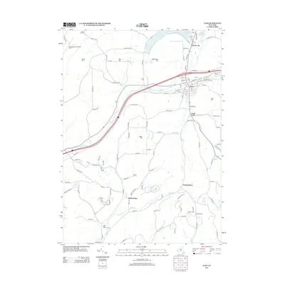
2013 Map of Cuba
USGS Topo · Published 2013About this map
Cuba and its surrounding countryside in Allegany and Cattaraugus counties are detailed in this 2013 survey, showcasing the dense residential grid of the village against the broad valleys of Oil Creek and Griffin Creek. The village layout is well-defined, including central landmarks like Our Lady of the Angels Catholic Cemetery and Cuba Cemetery. To the north, Cuba Lake and the Seneca Oil Spring highlight the historic water and mineral resources of the region, while the Cattaraugus County-Olean Airport anchors the northwestern corner of the quadrangle. Moving south, the landscape transitions toward rural settlements such as Germantown and Haskell Flats, where the terrain rises into prominent features like Keller Hill and Reservation Hill. This map provides genealogists and local researchers with a clear view of modern property access through named routes like Jackson Hill Road and Keller Hill Road, while documenting the enduring presence of family-named landmarks like Yardman Farm.
Find a feature on this map
126 named features on this map. Tap any name to fly to it.
Don’t see what you’re looking for? This feature index may not catch every label — zoom into the map to look around manually.
Map Details
Editions of this 2013 Cuba Map
This is the sole edition of this map. No revisions or reprints were ever made.
Other maps of this area

1898 · Olean
USGS Topo · 1:62,500

1906 · Angelica
USGS Topo · 1:62,500

1924 · Franklinville
USGS Topo · 1:62,500

1925 · Belmont
USGS Topo · 1:62,500

1938 · Olean
USGS Topo · 1:62,500

1939 · Belmont
USGS Topo · 1:62,500

1941 · Angelica
USGS Topo · 1:62,500

1942 · Franklinville
USGS Topo · 1:62,500

1943 · Olean
USGS Topo · 1:62,500

1960 · Buffalo
USGS Topo · 1:250,000