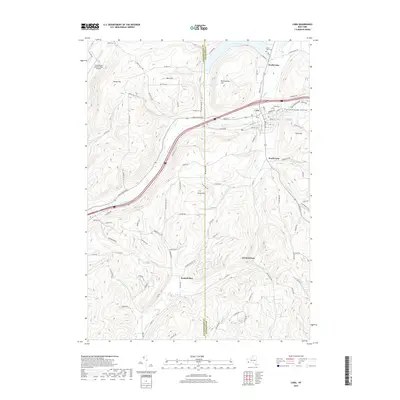
2019 Map of Cuba
USGS Topo · Published 2019About this map
Oil Creek flows through a valley defined by the sharp transition between the Allegany Co and Cattaraugus Co line, anchoring a series of settlements from North Cuba down to Haskell Flats. The landscape is a mix of agricultural plateaus like Burt Hill and the recreation-oriented waters of Cuba Lake. Local history is deeply embedded in the terrain, marked by several distinct burial grounds including Union Hill Cem and Our Lady of the Angels Catholic Cem. A notable geographic and cultural landmark, the Seneca Oil Spring, sits on Reservation Hill, while the Cattaraugus County-Olean Airport occupies the northwest corner. The map traces the winding paths of smaller waterways such as Griffin Cr and Wolf Run as they navigate the ridges of Cuba Hill and Keller Hill.
Find a feature on this map
102 named features on this map. Tap any name to fly to it.
Don’t see what you’re looking for? This feature index may not catch every label — zoom into the map to look around manually.
Map Details
Editions of this 2019 Cuba Map
This is the sole edition of this map. No revisions or reprints were ever made.
Other maps of this area

1898 · Olean
USGS Topo · 1:62,500

1906 · Angelica
USGS Topo · 1:62,500

1924 · Franklinville
USGS Topo · 1:62,500

1925 · Belmont
USGS Topo · 1:62,500

1938 · Olean
USGS Topo · 1:62,500

1939 · Belmont
USGS Topo · 1:62,500

1941 · Angelica
USGS Topo · 1:62,500

1942 · Franklinville
USGS Topo · 1:62,500

1943 · Olean
USGS Topo · 1:62,500

1960 · Buffalo
USGS Topo · 1:250,000