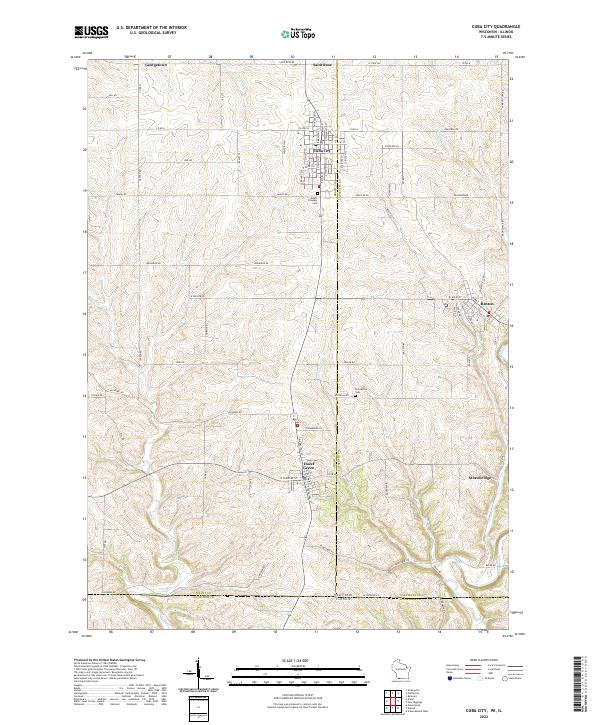
2022 Map of Cuba City
USGS Topo · Published 2022About this map
The drifting ridge-and-valley landscape of the Wisconsin and Illinois borderlands defines this area, where local economies have long been tied to the mineral-rich soils of the Driftless Area. Cuba City stands as a central hub at the intersection of Grant and Lafayette counties, while the historic mining and smelting centers of Hazel Green and Benton anchor the southern portion of the sheet. The drainage patterns of the Sinsinawa River and the Galena River carve through the terrain, illustrating the geographic factors that dictated early road placement and settlement growth.
Find a feature on this map
58 named features on this map. Tap any name to fly to it.
Don’t see what you’re looking for? This feature index may not catch every label — zoom into the map to look around manually.
Map Details
Editions of this 2022 Cuba City Map
This is the sole edition of this map. No revisions or reprints were ever made.
Other maps of this area

1900 · Lancaster
USGS Topo · 1:125,000

1901 · Peosta
USGS Topo · 1:125,000

1902 · Mineral Point
USGS Topo · 1:125,000

1904 · Lancaster
USGS Topo · 1:125,000

1908 · Lancaster
USGS Topo · 1:125,000

1911 · Galena
USGS Topo · 1:62,500

1913 · Galena
USGS Topo · 1:62,500

1935 · East Dubuque
USGS Topo · 1:62,500

1940 · East Dubuque
USGS Topo · 1:62,500

1952 · Platteville
USGS Topo · 1:24,000