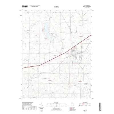
2017 Map of Cuba
USGS Topo · Published 2017About this map
The town of Cuba serves as the central hub of this Crawford County landscape, where the local street grid transitions into a network of outlying homesteads and agricultural tracts. A high concentration of burial sites, including Heron Cem, Fairclough Cem, and Kinder Cem, offers significant research value for genealogists tracing families in the area. The northern terrain is defined by the drainages of Pleasant Valley Cr and McDade Br, while the southern reaches follow the winding course of the Meramec River.
Find a feature on this map
147 named features on this map. Tap any name to fly to it.
Don’t see what you’re looking for? This feature index may not catch every label — zoom into the map to look around manually.
Map Details
Editions of this 2017 Cuba Map
This is the sole edition of this map. No revisions or reprints were ever made.
Other maps of this area

1903 · Sullivan
USGS Topo · 1:125,000

1928 · Meramec Spring
USGS Topo · 1:62,500

1932 · Steelville
USGS Topo · 1:48,000

1933 · Steelville
USGS Topo · 1:62,500

1934 · Redbird
USGS Topo · 1:62,500

1937 · Steelville
USGS Topo · 1:62,500

1938 · Redbird
USGS Topo · 1:62,500

1948 · Cuba
USGS Topo · 1:24,000

1948 · Leasburg
USGS Topo · 1:24,000

1948 · Argo
USGS Topo · 1:24,000