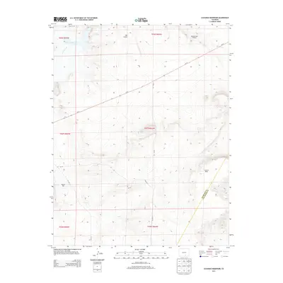
2013 Map of Cucharas Reservoir
USGS Topo · Published 2013About this map
Cucharas Reservoir dominates the northwestern corner of this 2013 landscape, where the Cucharas River flows through the high plains of southern Colorado. The map documents the arid geography along the Huerfano and Las Animas county line, a region characterized by dramatic elevation shifts and named topographic landmarks. Notable features include Cordova Mesa in the southeast and the broad expanse of Bustos Flat to the west. Local water sources, vital in this environment, are represented by Maes Spring and drainage systems like Vigil Canyon and Rattlesnake Canyon. The presence of roads such as Co-10 and several county routes illustrates the sparse but critical transportation network connecting these remote ranching and grazing lands.
Find a feature on this map
14 named features on this map. Tap any name to fly to it.
Don’t see what you’re looking for? This feature index may not catch every label — zoom into the map to look around manually.
Map Details
Editions of this 2013 Cucharas Reservoir Map
This is the sole edition of this map. No revisions or reprints were ever made.
Other maps of this area

1891 · Walsenburg
USGS Topo · 1:125,000

1891 · Apishapa
USGS Topo · 1:125,000

1893 · Apishapa
USGS Topo · 1:125,000

1894 · Walsenburg
USGS Topo · 1:125,000

1897 · Walsenburg
USGS Topo · 1:125,000

1897 · Apishapa
USGS Topo · 1:125,000

1900 · Walsenburg
USGS Topo · 1:125,000

1954 · Trinidad
USGS Topo · 1:250,000

1955 · Trinidad
USGS Topo · 1:250,000

1958 · Trinidad
USGS Topo · 1:250,000