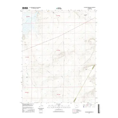
2016 Map of Cucharas Reservoir
USGS Topo · Published 2016About this map
Cucharas Reservoir dominates the northwestern corner of this high-plains landscape, where the Cucharas River flows through an arid terrain defined by sweeping mesas and canyons. This 2016 survey documents the rural borderlands between Huerfano and Las Animas counties, a region marked by expansive topographical features like Cordova Mesa and the wide expanse of Bustos Flat. The mapping of small-scale water sources, such as Maes Spring, highlights the critical importance of water management in this Colorado environment. The landscape is primarily accessible via a network of secondary routes including Co RD 210 and Co RD 214, reflecting a sparse settlement pattern where land use is dictated by the dramatic shifts in elevation between Vigil Canyon and the surrounding plateaus.
Find a feature on this map
19 named features on this map. Tap any name to fly to it.
Don’t see what you’re looking for? This feature index may not catch every label — zoom into the map to look around manually.
Map Details
Editions of this 2016 Cucharas Reservoir Map
This is the sole edition of this map. No revisions or reprints were ever made.
Other maps of this area

1891 · Walsenburg
USGS Topo · 1:125,000

1891 · Apishapa
USGS Topo · 1:125,000

1893 · Apishapa
USGS Topo · 1:125,000

1894 · Walsenburg
USGS Topo · 1:125,000

1897 · Walsenburg
USGS Topo · 1:125,000

1897 · Apishapa
USGS Topo · 1:125,000

1900 · Walsenburg
USGS Topo · 1:125,000

1954 · Trinidad
USGS Topo · 1:250,000

1955 · Trinidad
USGS Topo · 1:250,000

1958 · Trinidad
USGS Topo · 1:250,000