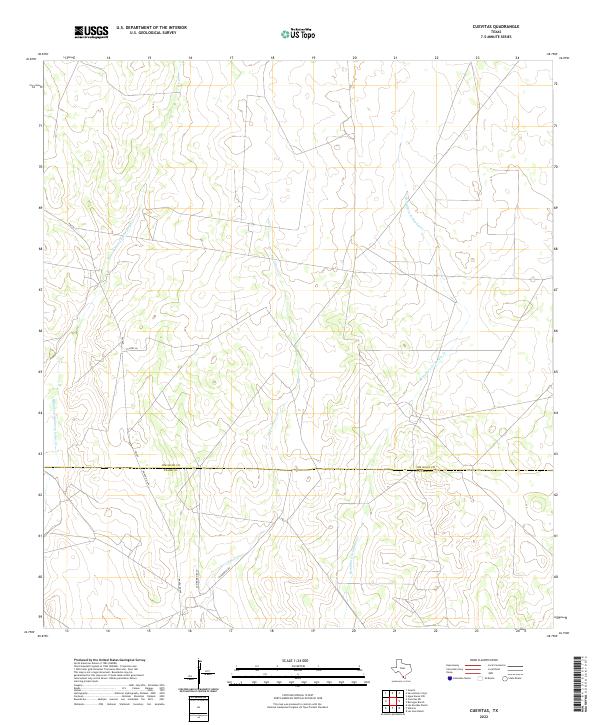
2022 Map of Cuevitas
USGS Topo · Published 2022About this map
Remadura de Charco Largo Cr and Los Olmos Cr define the drainage patterns across this South Texas brushland where Jim Hogg and Starr Counties meet. The landscape is primarily shaped by ranching interests and water management, with ephemeral streams like Remadura de Sandia Cr cutting through the terrain. Evidence of local land ownership and historical boundaries are present in labels such as San Roman Rch and Villarreal Rd, reflecting the heritage of regional families. Transportation in this sparsely populated area is anchored by FM 649 and Ranch Rd 649, providing essential north-south connectivity through the ranching districts. While contemporary in its 2022 survey, the map preserves the traditional place names and rural infrastructure characteristic of the Rio Grande Plains.
Find a feature on this map
9 named features on this map. Tap any name to fly to it.
Don’t see what you’re looking for? This feature index may not catch every label — zoom into the map to look around manually.
Map Details
Editions of this 2022 Cuevitas Map
This is the sole edition of this map. No revisions or reprints were ever made.
Other maps of this area

1938 · El Sauz
USGS Topo · 1:62,500

1938 · Agua Nueva
USGS Topo · 1:62,500

1938 · Sal Colorada
USGS Topo · 1:62,500

1938 · Cuevitas
USGS Topo · 1:62,500

1949 · Mc Allen
USGS Topo · 1:250,000

1954 · McAllen
USGS Topo · 1:250,000

1957 · Mc Allen
USGS Topo · 1:250,000

1962 · McAllen
USGS Topo · 1:250,000

1972 · Cuevitas
USGS Topo · 1:24,000
1972 · Guerra
USGS Topo · 1:24,000