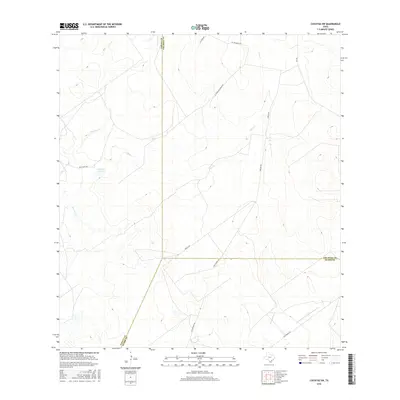
2016 Map of Cuevitas SW
USGS Topo · Published 2016About this map
The brush country of South Texas meets a complex network of ephemeral waterways in this 2016 survey of the area where Zapata, Jim Hogg, and Starr Counties converge. This arid landscape is defined by the drainage patterns of San Juan Cr and Chico Cr, which carve through the terrain toward the Rio Grande basin. The presence of P Flores Lake provides a rare localized water source in a region otherwise dominated by seasonal creek beds like Las Escobas Cr and Remadura de Charco Largo Cr. Human activity is primarily represented by a grid of ranch roads and specialized corridors such as Multi Shot Rd and El Tecolote Ranch Rd, reflecting the contemporary cattle ranching and energy infrastructure of the Rio Grande Plains.
Find a feature on this map
16 named features on this map. Tap any name to fly to it.
Don’t see what you’re looking for? This feature index may not catch every label — zoom into the map to look around manually.
Map Details
Editions of this 2016 Cuevitas SW Map
This is the sole edition of this map. No revisions or reprints were ever made.
Other maps of this area

1938 · Falcon
USGS Topo · 1:62,500

1938 · El Sauz
USGS Topo · 1:62,500

1938 · Cuevitas
USGS Topo · 1:62,500

1949 · Mc Allen
USGS Topo · 1:250,000

1954 · McAllen
USGS Topo · 1:250,000

1956 · Arroyo Clareno
USGS Topo · 1:62,500

1957 · Mc Allen
USGS Topo · 1:250,000

1962 · McAllen
USGS Topo · 1:250,000

1965 · Lopeno
USGS Topo · 1:24,000

1972 · Cuevitas
USGS Topo · 1:24,000