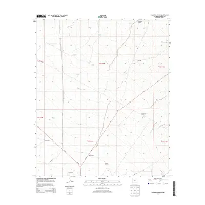
2013 Map of Culberson Ranch
USGS Topo · Published 2013About this map
Culberson Ranch sits at the heart of this high-desert landscape in Hidalgo County, defined by a complex network of seasonal water catchments and deep drainage systems. The survival and utility of the land are traced through numerous named tanks such as Willow Tank, Garland Tank, and Still Tank, which supported the local ranching economy in an arid environment. These water sources are scattered among prominent topographical features including Apache Canyon and Thompson Canyon. Transport in this remote corridor is facilitated by routes such as NM-90 and Us-70 E, which cut through the undulating terrain near the base of the mountains. The southern reaches of the map are particularly detailed with landmarks like Hoodoo Canyon and Gold Hill Canyon, suggesting the mineral and geological interest of the region. This 2013 survey provides a clear view of how modern infrastructure and traditional ranching outposts continue to coexist in the Southwestern desert.
Find a feature on this map
31 named features on this map. Tap any name to fly to it.
Don’t see what you’re looking for? This feature index may not catch every label — zoom into the map to look around manually.
Map Details
Editions of this 2013 Culberson Ranch Map
This is the sole edition of this map. No revisions or reprints were ever made.
Other maps of this area

1954 · Silver City
USGS Topo · 1:250,000

1958 · Silver City
USGS Topo · 1:250,000

1959 · Redrock
USGS Topo · 1:62,500

1959 · Canador Peak
USGS Topo · 1:62,500

1962 · Silver City
USGS Topo · 1:250,000

1962 · Lisbon
USGS Topo · 1:24,000

1963 · Lordsburg
USGS Topo · 1:24,000

1963 · Gold Hill
USGS Topo · 1:24,000

1963 · Culberson Ranch
USGS Topo · 1:24,000

1964 · Gary
USGS Topo · 1:24,000