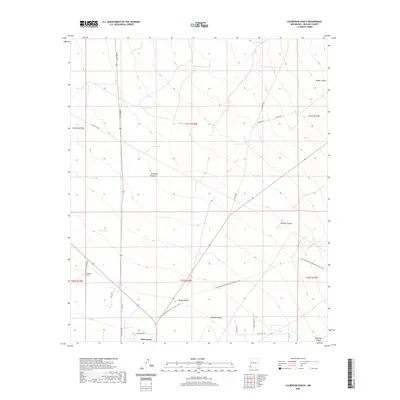
2020 Map of Culberson Ranch
USGS Topo · Published 2020About this map
The eponymous Culberson Ranch anchors this high-desert landscape in Hidalgo County, where water management is the primary driver of human settlement. The map reveals an intricate network of livestock watering holes, including Aikers Tank, Still Tank, and Garland Tank, scattered among the drainages of Thompson Canyon and Apache Canyon. This arid ranching territory is traversed by the Continental Divide National Scenic Trail, which snakes through the southern portion of the quadrangle near the community of Glen Acres. The layout of the land is defined by these sparse outposts and industrial infrastructure like the El Paso Gas Rd, illustrating the intersection of traditional southwestern ranching and modern utility corridors in the Bootheel region of New Mexico.
Find a feature on this map
35 named features on this map. Tap any name to fly to it.
Don’t see what you’re looking for? This feature index may not catch every label — zoom into the map to look around manually.
Map Details
Editions of this 2020 Culberson Ranch Map
This is the sole edition of this map. No revisions or reprints were ever made.
Other maps of this area

1954 · Silver City
USGS Topo · 1:250,000

1958 · Silver City
USGS Topo · 1:250,000

1959 · Redrock
USGS Topo · 1:62,500

1959 · Canador Peak
USGS Topo · 1:62,500

1962 · Silver City
USGS Topo · 1:250,000

1962 · Lisbon
USGS Topo · 1:24,000

1963 · Lordsburg
USGS Topo · 1:24,000

1963 · Gold Hill
USGS Topo · 1:24,000

1963 · Culberson Ranch
USGS Topo · 1:24,000

1964 · Gary
USGS Topo · 1:24,000