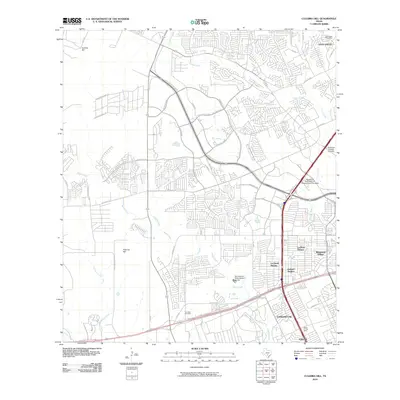
2010 Map of Culebra Hill
USGS Topo · Published 2010About this map
Leon Valley and the expanding residential corridors of western San Antonio define this 2010 landscape, where suburban growth meets the rising terrain of Culebra Hill and Padrone Hill. The map shows a complex network of neighborhoods, including Lackland Terrace, Westwood Village, and Lackland City, clustered near major transit arteries like the State Hwy 151 Access Rd. While much of the area is densely developed, several watercourses like Culebra Creek and Leon Creek bisect the suburban grid, following natural drainage patterns.
Find a feature on this map
61 named features on this map. Tap any name to fly to it.
Don’t see what you’re looking for? This feature index may not catch every label — zoom into the map to look around manually.
Map Details
Editions of this 2010 Culebra Hill Map
This is the sole edition of this map. No revisions or reprints were ever made.
Other maps of this area

1953 · Culebra Hill
USGS Topo · 1:24,000

1953 · San Antonio West
USGS Topo · 1:24,000

1953 · Terrell Wells
USGS Topo · 1:24,000

1953 · Macdona
USGS Topo · 1:24,000

1953 · Helotes
USGS Topo · 1:24,000

1953 · Castle Hills
USGS Topo · 1:24,000

1954 · San Antonio
USGS Topo · 1:250,000

1956 · Medina Lake
USGS Topo · 1:62,500

1957 · San Antonio
USGS Topo · 1:250,000

1958 · La Coste
USGS Topo · 1:24,000