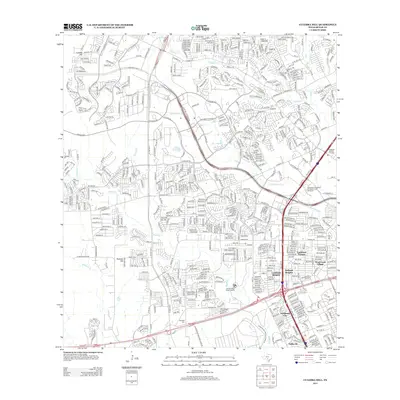
2013 Map of Culebra Hill
USGS Topo · Published 2013About this map
Culebra Hill and Padrone Hill anchor this western Bexar County landscape during a period of significant suburban expansion and infrastructure development. The map detail highlights the dense residential networks of Lackland Terrace, Kelland Heights, and Westwood Village, which are tightly integrated with major transportation corridors like W Us 90 and the State Hwy 151 Access Rd. This era of mapping shows the transition of traditional ranch lands into structured neighborhoods, though the underlying topography remains defined by the winding paths of Medio Cr, Potranca Cr, and Slick Ranch Cr.
Find a feature on this map
19 named features on this map. Tap any name to fly to it.
Don’t see what you’re looking for? This feature index may not catch every label — zoom into the map to look around manually.
Map Details
Editions of this 2013 Culebra Hill Map
This is the sole edition of this map. No revisions or reprints were ever made.
Other maps of this area

1953 · Culebra Hill
USGS Topo · 1:24,000

1953 · San Antonio West
USGS Topo · 1:24,000

1953 · Terrell Wells
USGS Topo · 1:24,000

1953 · Macdona
USGS Topo · 1:24,000

1953 · Helotes
USGS Topo · 1:24,000

1953 · Castle Hills
USGS Topo · 1:24,000

1954 · San Antonio
USGS Topo · 1:250,000

1956 · Medina Lake
USGS Topo · 1:62,500

1957 · San Antonio
USGS Topo · 1:250,000

1958 · La Coste
USGS Topo · 1:24,000