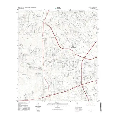
2016 Map of Culebra Hill
USGS Topo · Published 2016About this map
San Antonio expands westward in this 2016 record of Bexar County, where the transition from the rolling terrain of the Edwards Plateau to the coastal plains is marked by significant topographical landmarks like Culebra Hill and Padrone Hill. The landscape is a network of suburban development intertwined with vital drainage systems such as Helotes Cr, Culebra Cr, and Potranca Cr. This era shows the dense residential growth surrounding the Northwest Vista Coll and the integration of military-adjacent communities near Lackland City and Valley Hi. Educational and community anchors like the Sociedad Cem provide localized points of historical continuity amidst the rapid modern infrastructure of the State Hwy 151 Access Rd corridor and Leon Valley.
Find a feature on this map
23 named features on this map. Tap any name to fly to it.
Don’t see what you’re looking for? This feature index may not catch every label — zoom into the map to look around manually.
Map Details
Editions of this 2016 Culebra Hill Map
This is the sole edition of this map. No revisions or reprints were ever made.
Other maps of this area

1953 · Culebra Hill
USGS Topo · 1:24,000

1953 · San Antonio West
USGS Topo · 1:24,000

1953 · Terrell Wells
USGS Topo · 1:24,000

1953 · Macdona
USGS Topo · 1:24,000

1953 · Helotes
USGS Topo · 1:24,000

1953 · Castle Hills
USGS Topo · 1:24,000

1954 · San Antonio
USGS Topo · 1:250,000

1956 · Medina Lake
USGS Topo · 1:62,500

1957 · San Antonio
USGS Topo · 1:250,000

1958 · La Coste
USGS Topo · 1:24,000