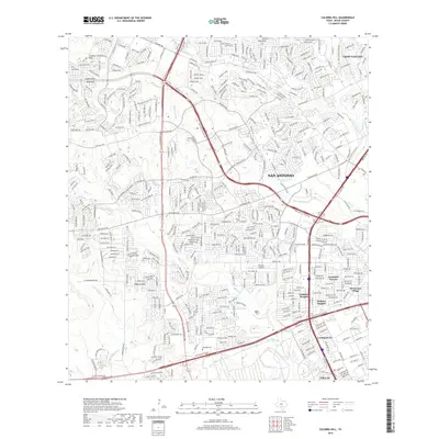
2019 Map of Culebra Hill
USGS Topo · Published 2019About this map
San Antonio expands westward toward the prominent heights of Culebra Hill and Padrone Hill in this modern topographical study. The landscape is defined by the heavy infrastructure of the C W Anderson Loop and State Hwy 151, which facilitate the growth of suburban enclaves like Leon Valley and Lackland Terrace. The map documents a complex network of residential developments and commercial corridors, contrasting with the natural drainage patterns of Medio Cr and Potranca Cr.
Find a feature on this map
45 named features on this map. Tap any name to fly to it.
Don’t see what you’re looking for? This feature index may not catch every label — zoom into the map to look around manually.
Map Details
Editions of this 2019 Culebra Hill Map
This is the sole edition of this map. No revisions or reprints were ever made.
Other maps of this area

1953 · Culebra Hill
USGS Topo · 1:24,000

1953 · San Antonio West
USGS Topo · 1:24,000

1953 · Terrell Wells
USGS Topo · 1:24,000

1953 · Macdona
USGS Topo · 1:24,000

1953 · Helotes
USGS Topo · 1:24,000

1953 · Castle Hills
USGS Topo · 1:24,000

1954 · San Antonio
USGS Topo · 1:250,000

1956 · Medina Lake
USGS Topo · 1:62,500

1957 · San Antonio
USGS Topo · 1:250,000

1958 · La Coste
USGS Topo · 1:24,000