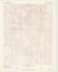
1967 Map of Culebra Peak
USGS Topo · Published 1971About this map
The high alpine Divide of the Sangre De Cristo Range dominates this late-1960s survey, marking the jagged boundary between Costilla and Las Animas counties. This area is characterized by steep drainage systems and prominent summits, including Culebra Peak and the nearby Purgatoire Peak. The map details the complex headwaters of various creeks that flow from these heights, such as Alamosito Creek and East Fork Costilla Creek.
Find a feature on this map
22 named features on this map. Tap any name to fly to it.
Don’t see what you’re looking for? This feature index may not catch every label — zoom into the map to look around manually.
Map Details
Editions of this 1967 Culebra Peak Map
2 editions found
Other maps of this area

1954 · Raton
USGS Topo · 1:250,000

1954 · Trinidad
USGS Topo · 1:250,000

1955 · Trinidad
USGS Topo · 1:250,000

1958 · Raton
USGS Topo · 1:250,000

1958 · Trinidad
USGS Topo · 1:250,000

1959 · Trinidad
USGS Topo · 1:250,000

1962 · Ash Mountain
USGS Topo · 1:62,500

1963 · Big Costilla Peak
USGS Topo · 1:24,000

1967 · La Valley
USGS Topo · 1:24,000

1967 · Taylor Ranch
USGS Topo · 1:24,000