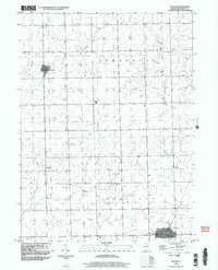
1998 Map of Cullom
USGS Topo · Published 2003About this map
Cullom and Emington serve as the primary hubs in this agricultural section of Livingston County during the late 1990s. The landscape is defined by the steady, gridded progress of the Public Land Survey System, which organizes the townships of Union, Broughton, and Sullivan. Waterways like Gooseberry Creek, Broughton Creek, and Fivemile Creek cut soft, meandering paths across the otherwise orderly square sections, providing natural drainage for the surrounding farmland.
Find a feature on this map
13 named features on this map. Tap any name to fly to it.
Don’t see what you’re looking for? This feature index may not catch every label — zoom into the map to look around manually.
Map Details
Editions of this 1998 Cullom Map
This is the sole edition of this map. No revisions or reprints were ever made.
Other maps of this area

1923 · Herscher
USGS Topo · 1:62,500

1925 · Herscher
USGS Topo · 1:62,500

1944 · Piper City
USGS Topo · 1:48,000

1947 · Piper City
USGS Topo · 1:62,500

1947 · Cullom
USGS Topo · 1:62,500

1948 · Dwight
USGS Topo · 1:62,500

1949 · Cullom
USGS Topo · 1:62,500

1950 · Dwight
USGS Topo · 1:62,500

1958 · Aurora
USGS Topo · 1:250,000

1958 · Peoria
USGS Topo · 1:250,000