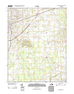
2013 Map of Culpeper East
USGS Topo · Published 2013About this map
Mount Pony rises as a prominent landmark south of Culpeper, anchoring a landscape where historical crossroads and agricultural heritage meet. This 2013 survey illustrates the modern footprint of settlements like Brandy Station and Stevensburg, connected by the arterial James Madison Hwy. The map reveals a transition from the developing neighborhoods of High Point and Belle Parc near the town center to the established rural character of the eastern reaches.
Find a feature on this map
85 named features on this map. Tap any name to fly to it.
Don’t see what you’re looking for? This feature index may not catch every label — zoom into the map to look around manually.
Map Details
Editions of this 2013 Culpeper East Map
This is the sole edition of this map. No revisions or reprints were ever made.
Other maps of this area

1887 · Spottsylvania
USGS Topo · 1:125,000

1892 · Spottsylvania
USGS Topo · 1:125,000

1892 · Gordonsville
USGS Topo · 1:125,000

1893 · Luray
USGS Topo · 1:125,000

1894 · Warrenton
USGS Topo · 1:125,000

1894 · Warrenton
USGS Topo · 1:62,500

1905 · Luray
USGS Topo · 1:125,000

1927 · Remington
USGS Topo · 1:48,000

1930 · Warrenton
USGS Topo · 1:62,500

1943 · Germanna Bridge
USGS Topo · 1:24,000