
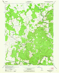
1943 Map of Germanna Bridge
USGS Topo · Published 1957About this map
Kellys Ford and the crossing at Germanna Bridge anchor this wartime landscape along the border of Culpeper, Fauquier, and Orange Counties. Surveyed in the early 1940s, the map reveals a rural network of crossroads communities and family-named landmarks. The village of Lignum serves as a local hub, supported by the South Lignum School and Hopewell Church. The terrain is defined by the winding courses of the Rappahannock River and Rapidan River, which historically dictated the movement of commerce and people in this region.
Find a feature on this map
19 named features on this map. Tap any name to fly to it.
Don’t see what you’re looking for? This feature index may not catch every label — zoom into the map to look around manually.
Map Details
Editions of this 1943 Germanna Bridge Map
2 editions found
Other maps of this area

1887 · Spottsylvania
USGS Topo · 1:125,000

1892 · Spottsylvania
USGS Topo · 1:125,000

1894 · Warrenton
USGS Topo · 1:125,000

1894 · Warrenton
USGS Topo · 1:62,500

1927 · Remington
USGS Topo · 1:48,000

1930 · Warrenton
USGS Topo · 1:62,500

1943 · Catlett
USGS Topo · 1:62,500

1943 · Chancellorsville
USGS Topo · 1:24,000

1943 · Culpeper
USGS Topo · 1:24,000

1943 · Midland
USGS Topo · 1:24,000