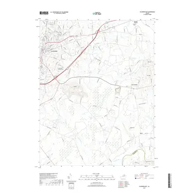
2019 Map of Culpeper East
USGS Topo · Published 2019About this map
The Culpeper County Courthouse stands as the historic anchor of this Piedmont landscape, which transitions from the urbanized streets of Culpeper into the broad agricultural reaches of the Culpeper Basin. Significant geological landmarks such as Mt Pony and Coles Hill rise above the surrounding terrain, providing a natural backdrop to the rural settlements of Stevensburg, Stony Point, and Batna. The map illustrates the contemporary development of the region, including the Germanna Community College Daniel Technology Center, set against established sites like the Masonic Cem.
Find a feature on this map
115 named features on this map. Tap any name to fly to it.
Don’t see what you’re looking for? This feature index may not catch every label — zoom into the map to look around manually.
Map Details
Editions of this 2019 Culpeper East Map
This is the sole edition of this map. No revisions or reprints were ever made.
Other maps of this area

1887 · Spottsylvania
USGS Topo · 1:125,000

1892 · Spottsylvania
USGS Topo · 1:125,000

1892 · Gordonsville
USGS Topo · 1:125,000

1893 · Luray
USGS Topo · 1:125,000

1894 · Warrenton
USGS Topo · 1:125,000

1894 · Warrenton
USGS Topo · 1:62,500

1905 · Luray
USGS Topo · 1:125,000

1927 · Remington
USGS Topo · 1:48,000

1930 · Warrenton
USGS Topo · 1:62,500

1943 · Germanna Bridge
USGS Topo · 1:24,000