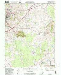
1994 Map of Culpeper East
USGS Topo · Published 1999About this map
Culpeper and its eastern environs are dominated by the significant landmark of Mount Pony, which rises sharply above the surrounding Piedmont landscape. The town itself shows a concentrated residential and institutional core, featuring the National Cem and several educational sites like the County High Sch and Richardson Sch. The Southern railroad line cuts through the landscape, a reminder of the corridor's long-standing importance for transportation between Washington and the south.
Find a feature on this map
42 named features on this map. Tap any name to fly to it.
Don’t see what you’re looking for? This feature index may not catch every label — zoom into the map to look around manually.
Map Details
Editions of this 1994 Culpeper East Map
This is the sole edition of this map. No revisions or reprints were ever made.
Other maps of this area

1887 · Spottsylvania
USGS Topo · 1:125,000

1892 · Spottsylvania
USGS Topo · 1:125,000

1892 · Gordonsville
USGS Topo · 1:125,000

1893 · Luray
USGS Topo · 1:125,000

1894 · Warrenton
USGS Topo · 1:125,000

1894 · Warrenton
USGS Topo · 1:62,500

1905 · Luray
USGS Topo · 1:125,000

1927 · Remington
USGS Topo · 1:48,000

1930 · Warrenton
USGS Topo · 1:62,500

1943 · Germanna Bridge
USGS Topo · 1:24,000