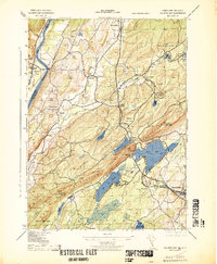
1943 Map of Culvers Gap
USGS Topo · Published 1943About this map
Kittatinny Mountain dominates the landscape of this 1943 War Department survey, marking a sharp geological divide in Sussex County. On its western slopes, the terrain descends toward the Delaware River, where the historic Dingmans Ferry provides a critical crossing point near the Delaware Cemetery. The map captures a moment of established rural life in Sandyston and Frankford townships before modern development altered the valley floor. Large tracts of land are preserved as Stokes State Forest and Richfield State Park, punctuated by seasonal camps like Kittatinny Camp and the Madeleine Mulford Girl Scout Camp. Local industry is represented by the Snooks Lumber Mill and a Gravel Pit, while the agricultural character is maintained by family tracts such as Sunny Bank Farm. The presence of several schools, including Sandyston School and Mt Pisgah School, highlights the social hubs of these small mountain communities.
Find a feature on this map
55 named features on this map. Tap any name to fly to it.
Don’t see what you’re looking for? This feature index may not catch every label — zoom into the map to look around manually.
Map Details
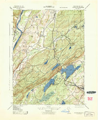
Editions of this 1943 Culvers Gap Map
2 editions found
Other maps of this area

1888 · Franklin
USGS Topo · 1:62,500

1891 · Wallpack
USGS Topo · 1:62,500

1893 · Wallpack
USGS Topo · 1:62,500

1894 · Franklin
USGS Topo · 1:62,500

1897 · Franklin
USGS Topo · 1:62,500

1903 · Franklin Furnace
USGS Topo · 1:62,500

1906 · Port Jervis
USGS Topo · 1:62,500

1908 · Port Jervis
USGS Topo · 1:62,500

1913 · Milford
USGS Topo · 1:62,500

1915 · Milford
USGS Topo · 1:62,500
Featured Places
- Hampton Township, NJ
- Stillwater Township, NJ
- Montague Township, NJ
- Branchville, NJ
- Sandyston Township, NJ