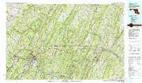
1981 Map of Cumberland
USGS Topo · Published 1993About this map
Cumberland stands as a central industrial and transportation hub at the junction of the North Branch Potomac River and Wills Creek. By the early 1980s, the landscape reflected over a century of heavy rail and water infrastructure, dominated by the Baltimore and Ohio Railroad and the historic Chesapeake and Ohio Canal. To the west, the Allegheny Front rises sharply, defining a ridge-and-valley geography where towns like Frostburg, Mount Savage, and Lonaconing developed around coal and manufacturing. The map detail highlights the dense network of valleys where settlements were dictated by the winding path of the Potomac River and its tributaries. Massive conservation areas like Savage River State Forest and Green Ridge State Forest cover the high ridges, preserving the natural character of the Appalachian highlands amidst the regional coal and timber history. This survey captures the region just as traditional industry and modern interstate travel via Interstate 70 began to reshape the tri-state borderlands of Maryland, Pennsylvania, and West Virginia.
Find a feature on this map
222 named features on this map. Tap any name to fly to it.
Don’t see what you’re looking for? This feature index may not catch every label — zoom into the map to look around manually.
Map Details
Editions of this 1981 Cumberland Map
2 editions found
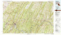
Other maps of this area

1884 · Harpers Ferry
USGS Topo · 1:125,000

1891 · Harpers Ferry
USGS Topo · 1:125,000

1891 · Romney
USGS Topo · 1:125,000

1893 · Harpers Ferry
USGS Topo · 1:125,000

1894 · Winchester
USGS Topo · 1:125,000

1895 · Piedmont
USGS Topo · 1:125,000

1898 · Frostburg
USGS Topo · 1:62,500

1898 · Paw Paw
USGS Topo · 1:62,500

1899 · Flintstone
USGS Topo · 1:62,500

1899 · Grantsville
USGS Topo · 1:62,500