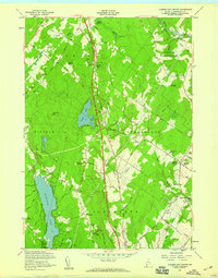
1957 Map of Cumberland Center
USGS Topo · Published 1959About this map
Cumberland Center and the surrounding townships of Cumberland, Falmouth, and North Yarmouth reveal a mid-century landscape of established village centers and expanding infrastructure. The core of the village is anchored by the Greely Institute and Sweetser Sch, while the agricultural heritage of the region is evidenced by the Cumberland Farmers Club. Transportation patterns show a clear transition, with the modern Maine Turnpike and its service facilities cutting north through the terrain, contrasting with the Old Railroad Grade near the Royal River.
Find a feature on this map
78 named features on this map. Tap any name to fly to it.
Don’t see what you’re looking for? This feature index may not catch every label — zoom into the map to look around manually.
Map Details
Editions of this 1957 Cumberland Center Map
4 editions found
Other maps of this area

1891 · Portland
USGS Topo · 1:62,500

1892 · Freeport
USGS Topo · 1:62,500

1893 · Portland
USGS Topo · 1:62,500

1893 · Casco Bay
USGS Topo · 1:62,500

1894 · Gray
USGS Topo · 1:62,500

1898 · Gray
USGS Topo · 1:62,500

1914 · Portland
USGS Topo · 1:48,000

1914 · Casco Bay
USGS Topo · 1:48,000

1916 · Portland
USGS Topo · 1:62,500

1916 · Casco Bay
USGS Topo · 1:62,500