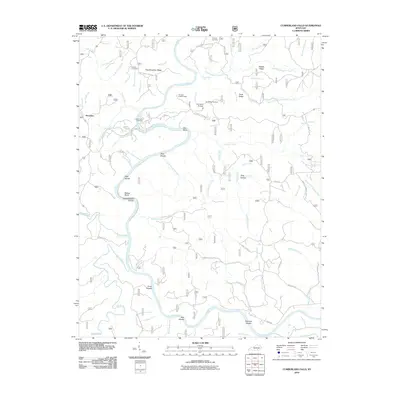
2010 Map of Cumberland Falls
USGS Topo · Published 2010About this map
The Cumberland River carves a deep path through McCreary County in this 2010 survey, winding past the small settlement of Honeybee. This rugged landscape within the Daniel Boone National Forest is defined by significant elevation changes and natural landmarks, including the Dog Slaughter Falls and the geological formation known as Dry Land Bridge. High-elevation vantage points like the Pinnacle Lookout Tower and Dry Bridge Overlook provide views across Dog Slaughter Ridge and the sharp oxbow of the Blue Bend. Local history is preserved in small family and community sites such as Mariar Cemetery and Ridener Cemetery, while the road network reflects the area's rural development with names like Bear Wallow School Rd and Oak Ridge Church Rd. The map also captures the many small waterways feeding the river, from Eagle Creek to the South Fork Dog Slaughter Creek, illustrating the complex drainage system of this forested plateau.
Find a feature on this map
80 named features on this map. Tap any name to fly to it.
Don’t see what you’re looking for? This feature index may not catch every label — zoom into the map to look around manually.
Map Details
Editions of this 2010 Cumberland Falls Map
This is the sole edition of this map. No revisions or reprints were ever made.
Other maps of this area

1890 · Williamsburg
USGS Topo · 1:125,000

1894 · Williamsburg
USGS Topo · 1:125,000

1952 · Wofford
USGS Topo · 1:24,000

1952 · Hail
USGS Topo · 1:24,000

1952 · Vox
USGS Topo · 1:24,000

1952 · Hollyhill
USGS Topo · 1:24,000

1952 · Wiborg
USGS Topo · 1:24,000

1952 · Cumberland Falls
USGS Topo · 1:24,000

1952 · Williamsburg
USGS Topo · 1:24,000

1952 · Whitley City
USGS Topo · 1:24,000