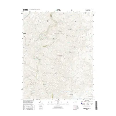
2016 Map of Cumberland Falls
USGS Topo · Published 2016About this map
The Cumberland River carves a deep, winding course through the heart of the Daniel Boone National Forest on the border of McCreary and Whitley counties. This 2014-indexed landscape is defined by its dramatic hydrology and steep topography, featuring notable landmarks such as McKee Bend, Dog Slaughter Falls, and the natural limestone feature known as Dry Land Bridge. Small family cemeteries, including Mariar Cem and Ridener Cem, are situated on the higher elevations of Dog Slaughter Ridge and Mid Ridge, offering a record of the area's rural heritage.
Find a feature on this map
79 named features on this map. Tap any name to fly to it.
Don’t see what you’re looking for? This feature index may not catch every label — zoom into the map to look around manually.
Map Details
Editions of this 2016 Cumberland Falls Map
This is the sole edition of this map. No revisions or reprints were ever made.
Other maps of this area

1890 · Williamsburg
USGS Topo · 1:125,000

1894 · Williamsburg
USGS Topo · 1:125,000

1952 · Wofford
USGS Topo · 1:24,000

1952 · Hail
USGS Topo · 1:24,000

1952 · Vox
USGS Topo · 1:24,000

1952 · Hollyhill
USGS Topo · 1:24,000

1952 · Wiborg
USGS Topo · 1:24,000

1952 · Cumberland Falls
USGS Topo · 1:24,000

1952 · Williamsburg
USGS Topo · 1:24,000

1952 · Whitley City
USGS Topo · 1:24,000