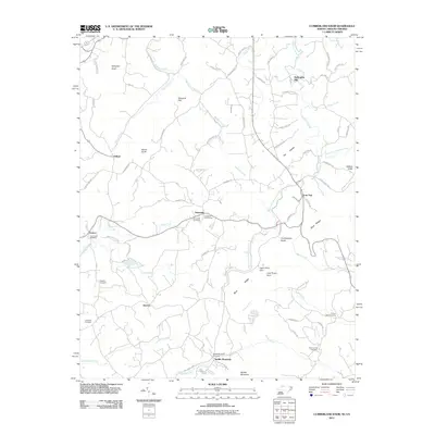
2011 Map of Cumberland Knob
USGS Topo · Published 2011About this map
Cumberland Knob rises along the border of North Carolina and Virginia, marking a high point in this 2011 survey of the Blue Ridge. The landscape is defined by the winding course of the Blue Ridge Pkwy, which threads past numerous family and community landmarks such as McKnights Mill and the Crestview Golf Course. The area's settlement history is etched into the terrain through a high density of small cemeteries, including Crab Creek Cemetery, Savannah Cemetery, and Higgins Cemetery, often situated near small clusters like Edmonds or Low Gap.
Find a feature on this map
76 named features on this map. Tap any name to fly to it.
Don’t see what you’re looking for? This feature index may not catch every label — zoom into the map to look around manually.
Map Details
Editions of this 2011 Cumberland Knob Map
This is the sole edition of this map. No revisions or reprints were ever made.
Other maps of this area

1889 · Hillsville
USGS Topo · 1:125,000

1889 · Wytheville
USGS Topo · 1:125,000

1889 · Wilkesboro
USGS Topo · 1:125,000

1891 · Wilkesboro
USGS Topo · 1:125,000

1891 · Yadkinville
USGS Topo · 1:125,000

1892 · Hillsville
USGS Topo · 1:125,000

1892 · Wytheville
USGS Topo · 1:125,000

1893 · Yadkinville
USGS Topo · 1:125,000

1896 · Hillsville
USGS Topo · 1:125,000

1930 · Independence
USGS Topo · 1:48,000