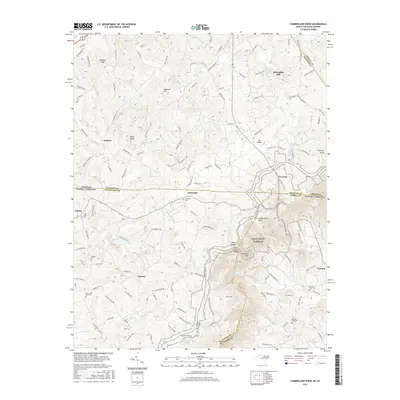
2016 Map of Cumberland Knob
USGS Topo · Published 2016About this map
The Blue Ridge Parkway winds along the crest of the Blue Ridge mountains, serving as the dominant corridor through this landscape where Virginia and North Carolina meet. This border region is defined by the high elevations of Cumberland Knob and Saddle Mtn, with the state line cutting across the upper reaches of the New River basin. Small, dispersed settlements like Edmonds, Ennice, and Lowgap are connected by narrow mountain roads, reflecting a long history of high-country agriculture and timbering. Numerous small burial grounds, including Savannah Cem and Fishers Gap Cem, are tucked away near these communities, offering significant points of interest for genealogical research. The complex drainage network is evidenced by the headwaters of Chestnut Creek and the Glady Fork, while landmarks like McKnights Mill point to the area's early rural industry.
Find a feature on this map
45 named features on this map. Tap any name to fly to it.
Don’t see what you’re looking for? This feature index may not catch every label — zoom into the map to look around manually.
Map Details
Editions of this 2016 Cumberland Knob Map
This is the sole edition of this map. No revisions or reprints were ever made.
Other maps of this area

1889 · Hillsville
USGS Topo · 1:125,000

1889 · Wytheville
USGS Topo · 1:125,000

1889 · Wilkesboro
USGS Topo · 1:125,000

1891 · Wilkesboro
USGS Topo · 1:125,000

1891 · Yadkinville
USGS Topo · 1:125,000

1892 · Hillsville
USGS Topo · 1:125,000

1892 · Wytheville
USGS Topo · 1:125,000

1893 · Yadkinville
USGS Topo · 1:125,000

1896 · Hillsville
USGS Topo · 1:125,000

1930 · Independence
USGS Topo · 1:48,000