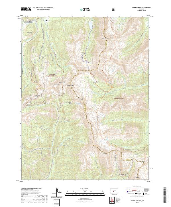
2022 Map of Cumberland Pass
USGS Topo · Published 2022About this map
High-altitude burial sites like Tincup Cem and Boothill Cem overlook the rugged topography of the Sawatch Range on this modern survey. The map details a high-country landscape defined by the Continental Divide, where the boundary between Gunnison Co and Chaffee Co follows the soaring ridgelines. Historic transportation routes are etched into the terrain, including the Alpine Tunnel Trl and the crossing at Cumberland Pass.
Find a feature on this map
64 named features on this map. Tap any name to fly to it.
Don’t see what you’re looking for? This feature index may not catch every label — zoom into the map to look around manually.
Map Details
Editions of this 2022 Cumberland Pass Map
This is the sole edition of this map. No revisions or reprints were ever made.
Other maps of this area

1934 · Taylor Park
USGS Topo · 1:62,500

1937 · Taylor Park
USGS Topo · 1:62,500

1940 · Garfield
USGS Topo · 1:62,500

1941 · Pitkin
USGS Topo · 1:62,500

1945 · Pitkin
USGS Topo · 1:62,500

1945 · Garfield
USGS Topo · 1:62,500

1955 · Mount Harvard
USGS Topo · 1:62,500

1956 · Montrose
USGS Topo · 1:250,000

1959 · Montrose
USGS Topo · 1:250,000

1960 · Montrose
USGS Topo · 1:250,000