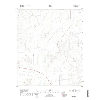
2019 Map of Cumbie Draw NE
USGS Topo · Published 2019About this map
The N Concho River winds through the southern portion of this Sterling County landscape, defining the local drainage system alongside several significant seasonal watercourses. This area of West Texas is characterized by a network of draws and creeks, including the westward-flowing Chalk Cr and the northern Hackberry Cr. The presence of Bodcaw Draw in the southeast corner further illustrates the complex hydrological layout that has long influenced land use and ranching boundaries in this region.
Find a feature on this map
9 named features on this map. Tap any name to fly to it.
Don’t see what you’re looking for? This feature index may not catch every label — zoom into the map to look around manually.
Map Details
Editions of this 2019 Cumbie Draw NE Map
This is the sole edition of this map. No revisions or reprints were ever made.
Other maps of this area

1954 · Big Spring
USGS Topo · 1:250,000

1954 · San Angelo
USGS Topo · 1:250,000

1958 · San Angelo
USGS Topo · 1:250,000

1958 · Big Spring
USGS Topo · 1:250,000

1959 · McWhorter Mountain
USGS Topo · 1:24,000

1963 · Cumbie Draw
USGS Topo · 1:24,000

1963 · Glass Ranch
USGS Topo · 1:24,000

1963 · Cumbie Draw NE
USGS Topo · 1:24,000

1963 · Buffalo Draw
USGS Topo · 1:24,000

1963 · Hayrick Mountain
USGS Topo · 1:24,000