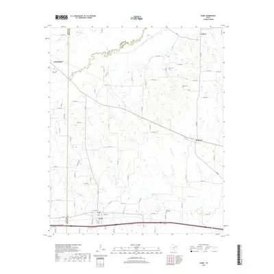
2019 Map of Cumby
USGS Topo · Published 2019About this map
The S Sulphur River forms the winding boundary between Delta and Hopkins Counties, defining the northern geography of this rural landscape. To the south, the settlement of Cumby serves as a local hub near Big Cr and Webb Cr, while smaller communities such as Ridgeway and Emblem are linked by a network of county roads. Family history is anchored in the presence of several small burial grounds, including Stewart Cem, Oakland Cem, and Pleasant Grove Cem, which are tucked away from the main thoroughfares. The drainage patterns of White Oak Cr and Merritt Cr illustrate the gentle dissection of the plains, where agricultural plots are interwoven with these primary watercourses. This contemporary survey captures the enduring rural character of the region where Hunt, Delta, and Hopkins Counties meet.
Find a feature on this map
77 named features on this map. Tap any name to fly to it.
Don’t see what you’re looking for? This feature index may not catch every label — zoom into the map to look around manually.
Map Details
Editions of this 2019 Cumby Map
This is the sole edition of this map. No revisions or reprints were ever made.
Other maps of this area

1953 · Texarkana
USGS Topo · 1:250,000

1956 · Texarkana
USGS Topo · 1:250,000

1962 · Lone Oak North
USGS Topo · 1:24,000

1962 · Miller Grove
USGS Topo · 1:24,000

1962 · Brashear
USGS Topo · 1:24,000

1964 · Cumby
USGS Topo · 1:24,000

1964 · Commerce South
USGS Topo · 1:24,000

1964 · Gafford Chapel
USGS Topo · 1:24,000

1964 · Klondike
USGS Topo · 1:24,000

1964 · Commerce North
USGS Topo · 1:24,000