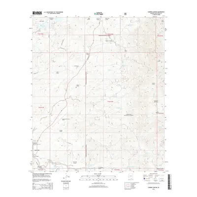
2014 Map of Cumero Canyon
USGS Topo · Published 2014About this map
Coronado National Forest dominates the high ground of the Patagonia Mountains in this desert landscape, where seasonal drainages and water-management features define the local geography. The presence of numerous tanks and springs, such as Jarillas Tank and Flux Spring, indicates the critical role of water for ranching and wildlife in this arid region of Santa Cruz County. The Santa Cruz River corridor serves as a focal point for settlement and infrastructure, passing near the community of Beyerville and supporting Buena Vista Lake. Further south, the Nogales International Airport sits near Tascala Canyon, marking a modern gateway to the borderlands. The terrain is marked by significant vertical relief, from the low-lying river valley to the heights of Guajalote Peak, with numerous deep canyons like Guevavi Canyon and Wild Hog Canyon cutting through the mountains.
Find a feature on this map
72 named features on this map. Tap any name to fly to it.
Don’t see what you’re looking for? This feature index may not catch every label — zoom into the map to look around manually.
Map Details
Editions of this 2014 Cumero Canyon Map
This is the sole edition of this map. No revisions or reprints were ever made.
Other maps of this area

1904 · Patagonia
USGS Topo · 1:125,000

1905 · Patagonia
USGS Topo · 1:125,000

1905 · Nogales
USGS Topo · 1:125,000

1922 · Agus Caliente
USGS Topo · 1:62,500

1932 · Lochiel
USGS Topo · 1:62,500

1932 · Elgin
USGS Topo · 1:62,500

1933 · Calabasas
USGS Topo · 1:62,500

1940 · Elgin
USGS Topo · 1:62,500

1947 · Elgin
USGS Topo · 1:62,500

1948 · Harshaw
USGS Topo · 1:24,000