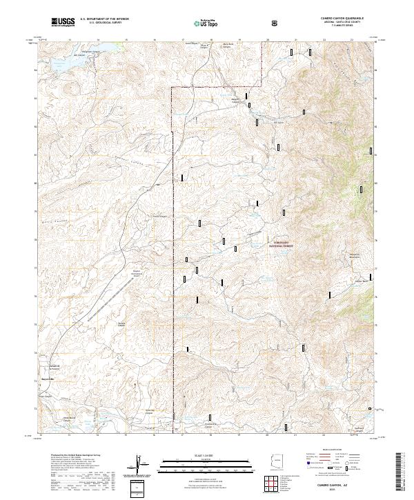
2021 Map of Cumero Canyon
USGS Topo · Published 2021About this map
Patagonia Lake and the high ridges of the Patagonia Mountains define this section of Santa Cruz County, where modern infrastructure meets a landscape deeply marked by ranching and resource management. The map details a complex network of water catchments including Barriles Tank, Maggies Tank, and Tres de Mayo Tank, illustrating the critical role of water storage in this arid environment. To the south, the Nogales International Airport sits as a contemporary landmark near the settlement of Beyerville, while much of the eastern portion of the quadrangle is preserved as part of the Coronado National Forest. This terrain is dissected by numerous named drainages such as Guevavi Canyon and Flux Canyon, providing a clear view of the topographic relief leading up to summits like Guajolote Peak.
Find a feature on this map
71 named features on this map. Tap any name to fly to it.
Don’t see what you’re looking for? This feature index may not catch every label — zoom into the map to look around manually.
Map Details
Editions of this 2021 Cumero Canyon Map
This is the sole edition of this map. No revisions or reprints were ever made.
Other maps of this area

1904 · Patagonia
USGS Topo · 1:125,000

1905 · Patagonia
USGS Topo · 1:125,000

1905 · Nogales
USGS Topo · 1:125,000

1922 · Agus Caliente
USGS Topo · 1:62,500

1932 · Lochiel
USGS Topo · 1:62,500

1932 · Elgin
USGS Topo · 1:62,500

1933 · Calabasas
USGS Topo · 1:62,500

1940 · Elgin
USGS Topo · 1:62,500

1947 · Elgin
USGS Topo · 1:62,500

1948 · Harshaw
USGS Topo · 1:24,000