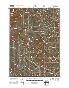
2011 Map of Cummins Peak
USGS Topo · Published 2011About this map
Pawn sits at the confluence where the West Branch North Fork Siuslaw River meets the North Fork Siuslaw River, marking a focal point for this heavily forested portion of Lane County. The landscape is defined by its complex drainage systems and prominent ridgelines, including Klickitat Ridge and Grizzly Ridge, which divide the waters flowing toward the Yachats R to the north from those feeding the Siuslaw system to the south. This 2011 survey documents a remote interior of the Oregon Coast Range, where peaks like Cummins Peak and Saddle Mountain tower over a network of service roads. The map reveals the isolation of early 21st-century coastal mountain life, with Clover Camp and scattered family-named ridges such as Formander Ridge suggesting a history tied to logging and forest management. Numerous tributary streams like Tenmile Creek and Indian Creek carve deep into the terrain, illustrating the hydrologic importance of these highlands.
Find a feature on this map
43 named features on this map. Tap any name to fly to it.
Don’t see what you’re looking for? This feature index may not catch every label — zoom into the map to look around manually.
Map Details
Editions of this 2011 Cummins Peak Map
This is the sole edition of this map. No revisions or reprints were ever made.
Other maps of this area

1918 · Mapleton
USGS Topo · 1:48,000

1920 · Heceta Head
USGS Topo · 1:62,500

1922 · Waldport
USGS Topo · 1:62,500

1940 · Mapleton
USGS Topo · 1:62,500

1942 · Waldport
USGS Topo · 1:62,500

1942 · Heceta Head
USGS Topo · 1:62,500

1942 · Tidewater
USGS Topo · 1:62,500

1945 · Mapleton
USGS Topo · 1:62,500

1953 · Salem
USGS Topo · 1:250,000

1954 · Salem
USGS Topo · 1:250,000