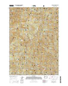
2014 Map of Cummins Peak
USGS Topo · Published 2014About this map
Siuslaw National Forest encompasses the entirety of this coastal Oregon landscape, dominated by a series of high ridges and a complex network of drainages. The area is defined by the high elevations of Cummins Peak and Klickitat Mtn, with local history preserved at the site of Madera Grave near the Klickitat Ridge. This territory, largely managed for timber and conservation, shows an extensive system of forest development roads, such as Natl Forest Develop Road 56 RD and Big Creek Rd, which provide access to the remote interior.
Find a feature on this map
59 named features on this map. Tap any name to fly to it.
Don’t see what you’re looking for? This feature index may not catch every label — zoom into the map to look around manually.
Map Details
Editions of this 2014 Cummins Peak Map
This is the sole edition of this map. No revisions or reprints were ever made.
Other maps of this area

1918 · Mapleton
USGS Topo · 1:48,000

1920 · Heceta Head
USGS Topo · 1:62,500

1922 · Waldport
USGS Topo · 1:62,500

1940 · Mapleton
USGS Topo · 1:62,500

1942 · Waldport
USGS Topo · 1:62,500

1942 · Heceta Head
USGS Topo · 1:62,500

1942 · Tidewater
USGS Topo · 1:62,500

1945 · Mapleton
USGS Topo · 1:62,500

1953 · Salem
USGS Topo · 1:250,000

1954 · Salem
USGS Topo · 1:250,000