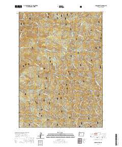
2020 Map of Cummins Peak
USGS Topo · Published 2020About this map
Siuslaw National Forest encompasses this highly dissected portion of Lane County, where a dense network of watercourses drains toward the Pacific coast. The geography is defined by prominent ridges and peaks, most notably Cummins Peak and Saddle Mtn. The Yachats River and its various tributaries, such as McKinney Cr and Stump Cr, carve deep into the terrain. A rare human landmark in this wilderness setting is Maderis Grave, located near Klickitat Mtn on the divide between the river and N Fork Indian Cr. The southern portion of the quadrangle shows the headwaters of the N Fork Siuslaw River and Taylor Cr, flowing southward away from the high ground of Drew Ridge. This map captures a landscape largely shaped by its natural drainage patterns, including the notable Saddle Mountain Springs and numerous named forks of Tenmile Cr.
Find a feature on this map
50 named features on this map. Tap any name to fly to it.
Don’t see what you’re looking for? This feature index may not catch every label — zoom into the map to look around manually.
Map Details
Editions of this 2020 Cummins Peak Map
This is the sole edition of this map. No revisions or reprints were ever made.
Other maps of this area

1918 · Mapleton
USGS Topo · 1:48,000

1920 · Heceta Head
USGS Topo · 1:62,500

1922 · Waldport
USGS Topo · 1:62,500

1940 · Mapleton
USGS Topo · 1:62,500

1942 · Waldport
USGS Topo · 1:62,500

1942 · Heceta Head
USGS Topo · 1:62,500

1942 · Tidewater
USGS Topo · 1:62,500

1945 · Mapleton
USGS Topo · 1:62,500

1953 · Salem
USGS Topo · 1:250,000

1954 · Salem
USGS Topo · 1:250,000