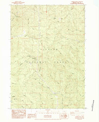
1984 Map of Cummins Peak
USGS Topo · Published 1984About this map
Cummins Peak and the high ridges of the Siuslaw National Forest define this landscape along the Oregon coast in the mid-1980s. The map documents a complex drainage system where Cummins Creek and Tenmile Creek flow toward the Pacific, while the North Fork Siuslaw River carves through the southern section. High-altitude markers like the Weather Station on the peak and an Open water tank near Saddle Mountain indicate the remote utility of these heights.
Find a feature on this map
50 named features on this map. Tap any name to fly to it.
Don’t see what you’re looking for? This feature index may not catch every label — zoom into the map to look around manually.
Map Details
Editions of this 1984 Cummins Peak Map
This is the sole edition of this map. No revisions or reprints were ever made.
Other maps of this area

1918 · Mapleton
USGS Topo · 1:48,000

1920 · Heceta Head
USGS Topo · 1:62,500

1922 · Waldport
USGS Topo · 1:62,500

1940 · Mapleton
USGS Topo · 1:62,500

1942 · Waldport
USGS Topo · 1:62,500

1942 · Heceta Head
USGS Topo · 1:62,500

1942 · Tidewater
USGS Topo · 1:62,500

1945 · Mapleton
USGS Topo · 1:62,500

1953 · Salem
USGS Topo · 1:250,000

1954 · Salem
USGS Topo · 1:250,000