
1933 Map of Cunningham Mtn
USGS Topo · Published 1933About this map
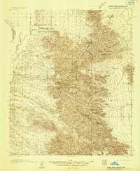
The Dome Rock Range dominates this 1933 survey, marking a rugged landscape of mineral exploration and transit along the Arizona-California border. In the northwest, the Colorado River Indian Reservation meets the river's edge near Goodman Slough, while a network of desert infrastructure supports the region's mining and travel. Early motorists navigated the Route No. 60 Sunkist Trail and the Parker Blythe Road, while prospectors worked claims such as the Darling Mine, Goodman Mine, and the Copper Bottom Mine. Strategic water points like La Paz Well and Gonzales Well were vital for survival in the arid terrain between the peaks and the La Posa Plain. This era represents the peak of desert trail reliance before modern highways fully transformed the Mojave and Sonoran transitions.
Find a feature on this map
37 named features on this map. Tap any name to fly to it.
Don’t see what you’re looking for? This feature index may not catch every label — zoom into the map to look around manually.
Map Details
Editions of this 1933 Cunningham Mtn Map
4 editions found
Other maps of this area

1930 · Linskey
USGS Topo · 1:62,500

1931 · Moon Mtn
USGS Topo · 1:62,500

1932 · Moon Mtn
USGS Topo · 1:62,500

1934 · Trigo Peaks
USGS Topo · 1:48,000

1939 · Trigo Peaks
USGS Topo · 1:62,500

1940 · Dome Rock Mts
USGS Topo · 1:62,500

1942 · Blythe
USGS Topo · 1:250,000

1942 · MOON MTN
USGS Topo · 1:62,500

1945 · Big Maria Mtns
USGS Topo · 1:62,500

1945 · Cibola
USGS Topo · 1:62,500