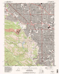
1991 Map of Cupertino
USGS Topo · Published 1995About this map
The Santa Cruz Mountains rise above the expanding suburban landscape of the Santa Clara Valley in this detailed 1991 revision. The contrast between industrial and residential growth is evident near Monta Vista, where a large Cement Plant and several Quarry sites sit adjacent to developing neighborhoods and the Juniper Serra Freeway. Local education and religious history are anchored by institutions like the St Joseph Seminary, Maryknoll Seminary, and the campus of De Anza College.
Find a feature on this map
121 named features on this map. Tap any name to fly to it.
Don’t see what you’re looking for? This feature index may not catch every label — zoom into the map to look around manually.
Map Details
Editions of this 1991 Cupertino Map
2 editions found
Other maps of this area

1889 · San Jose
USGS Topo · 1:62,500

1897 · San Jose
USGS Topo · 1:62,500

1897 · Palo Alto
USGS Topo · 1:62,500

1899 · San Jose
USGS Topo · 1:62,500

1899 · Palo Alto
USGS Topo · 1:62,500

1902 · Santa Cruz
USGS Topo · 1:125,000

1916 · New Almaden
USGS Topo · 1:48,000

1919 · New Almaden
USGS Topo · 1:62,500

1940 · Los Gatos
USGS Topo · 1:62,500

1941 · Palo Alto
USGS Topo · 1:62,500