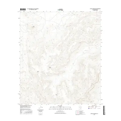
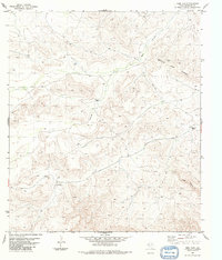
2016 Map of Cupola Mountain
USGS Topo · Published 2016About this map
Cupola Mtn and Black Mtn define the high desert topography of this Brewster County region, where the land is carved by deep, winding drainages. The drainage patterns of Big Canyon and Reagan Canyon dominate the central and southern portions of the terrain, illustrating the dramatic elevation shifts characteristic of the Big Bend country. This 2016 survey by the U.S. Geological Survey captures a landscape largely defined by its natural geomorphology rather than human infrastructure, showing the isolation of these peaks and the complex network of ephemeral waterways that have shaped the limestone and volcanic features over millennia. For those studying the remote borderlands of West Texas, this map provides a precise record of the vertical relief and the intricate drainage systems that define this part of the Trans-Pecos.
Find a feature on this map
4 named features on this map. Tap any name to fly to it.
Don’t see what you’re looking for? This feature index may not catch every label — zoom into the map to look around manually.
Map Details
Editions of this 2016 Cupola Mountain Map
This is the sole edition of this map. No revisions or reprints were ever made.
Other maps of this area

1918 · Reagan Canyon
USGS Topo · 1:62,500

1918 · Dove Mountain
USGS Topo · 1:62,500

1918 · Bullis Gap
USGS Topo · 1:62,500

1919 · Maravillas Canyon
USGS Topo · 1:62,500

1959 · Emory Peak
USGS Topo · 1:250,000

1965 · Emory Peak
USGS Topo · 1:250,000
1983 · Las Vegas De Los Ladrones SW
USGS Topo · 1:24,000
1983 · Black Gap
USGS Topo · 1:24,000
1983 · Bourland Canyon
USGS Topo · 1:24,000
1983 · Beef Gap
USGS Topo · 1:24,000