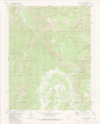
1980 Map of Curley Peak
USGS Topo · Published 1983About this map
Yorkville and the small settlement of Democrat anchor this 1980 study of the Southern Colorado highlands. Located within the San Isabel National Forest, the landscape is defined by the steep drainage of Grape Creek and its many tributaries, including the colorfully named Isinglass Gulch and Hellgate Gulch. The terrain is characterized by high summits such as Tanner Peak and Curley Peak, which overlook the complex network of Scrapping Ridges.
Find a feature on this map
47 named features on this map. Tap any name to fly to it.
Don’t see what you’re looking for? This feature index may not catch every label — zoom into the map to look around manually.
Map Details
Editions of this 1980 Curley Peak Map
3 editions found
Other maps of this area

1889 · Canon City
USGS Topo · 1:125,000

1892 · Canon City
USGS Topo · 1:125,000

1954 · Mount Tyndall
USGS Topo · 1:24,000

1954 · Pueblo
USGS Topo · 1:250,000

1955 · Westcliffe
USGS Topo · 1:24,000

1957 · Pueblo
USGS Topo · 1:250,000

1958 · Pueblo
USGS Topo · 1:250,000
1959 · Canon City
USGS Topo · 1:24,000

1959 · Rockvale
USGS Topo · 1:24,000

1959 · Royal Gorge
USGS Topo · 1:62,500