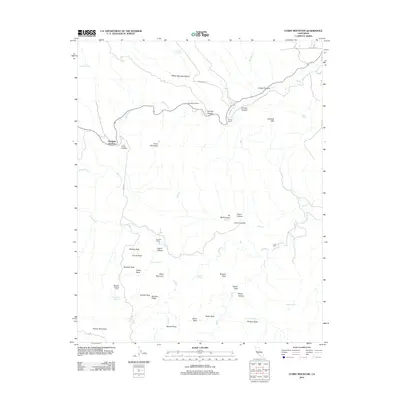
2012 Map of Curry Mountain
USGS Topo · Published 2012About this map
Warthan Cr carves a prominent path through this corner of Fresno County, where the high-relief landscape is defined by named peaks and remote ranching operations. The topography is dotted with family-named sites such as Sanderson Ranch, Alcalde Ranch, and the Marcelin Roberts Ranch. Significant landmarks such as Wildcat Rock, Church Rock, and Swallow Rock rise above the canyons, indicating a geologically complex environment within the Jacalitos Hills.
Find a feature on this map
50 named features on this map. Tap any name to fly to it.
Don’t see what you’re looking for? This feature index may not catch every label — zoom into the map to look around manually.
Map Details
Editions of this 2012 Curry Mountain Map
This is the sole edition of this map. No revisions or reprints were ever made.
Other maps of this area

1912 · Coalinga
USGS Topo · 1:125,000

1914 · Cholame
USGS Topo · 1:125,000

1915 · Priest Valley
USGS Topo · 1:125,000

1915 · Cholame
USGS Topo · 1:125,000

1917 · Cholame
USGS Topo · 1:125,000

1919 · San Miguel
USGS Topo · 1:62,500

1934 · The Dark Hole
USGS Topo · 1:31,680

1936 · Kreyenhagen Hills
USGS Topo · 1:31,680
1937 · The Dark Hole
USGS Topo · 1:31,680
1941 · Kreyenhagen Hills
USGS Topo · 1:31,680