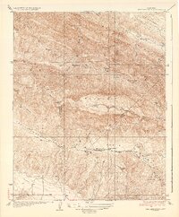
1937 Map of The Dark Hole
USGS Topo · Published 1937About this map
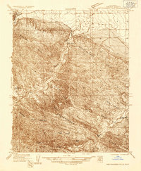
The rugged intersection of Fresno, Monterey, and Kings Counties comes into sharp focus during the mid-1930s. This high-altitude landscape is defined by the steep transition from the Kreyenhagen Hills down into the deep incision of The Dark Hole Canyon. Remote life in these mountains is marked by a network of isolated homesteads and surveyor camps, including Moore Cabin, Shields Cabin, and Twentysix Camp. A notable point of human activity in this otherwise wild terrain is the Pinosa House (Ruins) located along Arroyo Pinoso.
Find a feature on this map
38 named features on this map. Tap any name to fly to it.
Don’t see what you’re looking for? This feature index may not catch every label — zoom into the map to look around manually.
Map Details
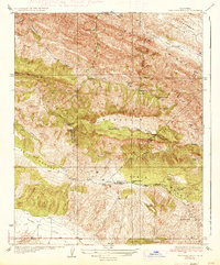
Editions of this 1937 The Dark Hole Map
2 editions found
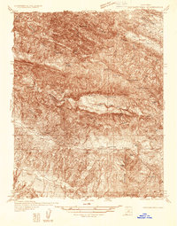
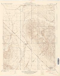
Other maps of this area

1912 · Coalinga
USGS Topo · 1:125,000

1914 · Cholame
USGS Topo · 1:125,000

1915 · Cholame
USGS Topo · 1:125,000

1917 · Cholame
USGS Topo · 1:125,000

1930 · Canoas Creek
USGS Topo · 1:31,680
1934 · The Dark Hole
USGS Topo · 1:31,680

1934 · Reef Ridge
USGS Topo · 1:31,680
1934 · Canoas Creek
USGS Topo · 1:31,680
1936 · Kreyenhagen Hills
USGS Topo · 1:31,680

1937 · Reef Ridge
USGS Topo · 1:31,680