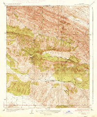
1937 Map of The Dark Hole
USGS Topo · Published 1937About this map
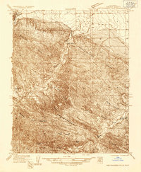
The Dark Hole defines the center of this 1934 survey, a distinctive topographic depression hemmed in by the heights of Black Mountain and Reef Ridge. This high-desert landscape, where the borders of Fresno, Monterey, and Kings counties meet, is marked by a network of isolated homesteads and seasonal camps. Family names are etched into the terrain at Shields Cabin, Moore Cabin, and Riley Cabin, indicating a history of ranching or prospecting in the remote canyons of the Kreyenhagen Hills.
Find a feature on this map
33 named features on this map. Tap any name to fly to it.
Don’t see what you’re looking for? This feature index may not catch every label — zoom into the map to look around manually.
Map Details
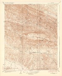
Editions of this 1937 The Dark Hole Map
2 editions found
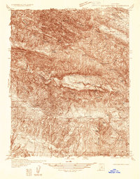
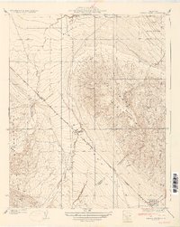
Other maps of this area

1912 · Coalinga
USGS Topo · 1:125,000

1914 · Cholame
USGS Topo · 1:125,000

1915 · Cholame
USGS Topo · 1:125,000

1917 · Cholame
USGS Topo · 1:125,000

1930 · Canoas Creek
USGS Topo · 1:31,680
1934 · The Dark Hole
USGS Topo · 1:31,680

1934 · Reef Ridge
USGS Topo · 1:31,680
1934 · Canoas Creek
USGS Topo · 1:31,680
1936 · Kreyenhagen Hills
USGS Topo · 1:31,680

1937 · Reef Ridge
USGS Topo · 1:31,680