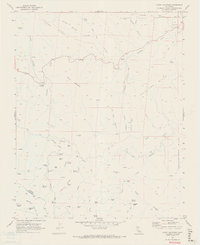
1969 Map of Curry Mountain
USGS Topo · Published 1973About this map
Parkfield Junction serves as a lonely crossroads in this 1969 survey of the high country along the Fresno and Monterey County line. The landscape is defined by the canyon-cut ridges of Juniper Ridge and the Jacalitos Hills, where the petroleum industry marks the northern reaches at the Coalinga Oil Field and Firestone Oil Field. Isolated outposts like Jacalitos Ranch and Dias Cabin are connected by the winding Parkfield Grade and numerous jeep trails that follow the dry beds of Jacalitos Creek and Warthan Creek. Notable landmarks such as Black Mountain, Wildcat Rock, and Church Rock rise above the drainage systems, providing orientation for cattle ranchers and oil prospectors moving through the canyons of Oak Flat and Oil Well Canyon.
Find a feature on this map
60 named features on this map. Tap any name to fly to it.
Don’t see what you’re looking for? This feature index may not catch every label — zoom into the map to look around manually.
Map Details
Editions of this 1969 Curry Mountain Map
2 editions found
Other maps of this area

1912 · Coalinga
USGS Topo · 1:125,000

1914 · Cholame
USGS Topo · 1:125,000

1915 · Priest Valley
USGS Topo · 1:125,000

1915 · Cholame
USGS Topo · 1:125,000

1917 · Cholame
USGS Topo · 1:125,000

1919 · San Miguel
USGS Topo · 1:62,500

1934 · The Dark Hole
USGS Topo · 1:31,680

1936 · Kreyenhagen Hills
USGS Topo · 1:31,680
1937 · The Dark Hole
USGS Topo · 1:31,680
1941 · Kreyenhagen Hills
USGS Topo · 1:31,680