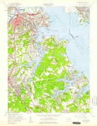
1957 Map of Curtis Bay
USGS Topo · Published 1960About this map
Industrial expansion and residential growth define the southern reaches of Baltimore and northern Anne Arundel County in the late 1950s. The shoreline along Curtis Bay and the Patapsco River is dominated by massive infrastructure, including the Curtis Bay Army Ordnance Depot, the U S Quarantine Sta, and the extensive tracks of the Baltimore and Ohio RR. These facilities sit adjacent to established neighborhoods like Brooklyn and Fairfield, illustrating the dense proximity of post-war industry and housing.
Find a feature on this map
105 named features on this map. Tap any name to fly to it.
Don’t see what you’re looking for? This feature index may not catch every label — zoom into the map to look around manually.
Map Details
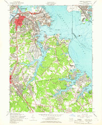
Editions of this 1957 Curtis Bay Map
2 editions found
Other maps of this area

1893 · North Point
USGS Topo · 1:62,500

1893 · Gunpowder
USGS Topo · 1:62,500

1894 · Baltimore
USGS Topo · 1:62,500

1894 · Relay
USGS Topo · 1:62,500

1898 · Tolchester
USGS Topo · 1:125,000

1899 · Baltimore
USGS Topo · 1:62,500

1901 · Gunpowder
USGS Topo · 1:62,500

1903 · Tolchester
USGS Topo · 1:125,000

1904 · Baltimore
USGS Topo · 1:62,500

1904 · North Point
USGS Topo · 1:62,500