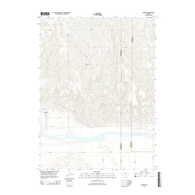
2014 Map of Cushing
USGS Topo · Published 2014About this map
Cushing sits on a high terrace north of the Loup River valley, serving as the primary settlement where Centre Ave meets Cushing Rd. The surrounding landscape is defined by the deeply incised drainage of Rock Cr, which carved the undulating terrain that dominates the center of the quadrangle. Local genealogy is grounded at the Rock Creek Cem, situated on a ridge between Brady Rd and Rock Cr.
Find a feature on this map
27 named features on this map. Tap any name to fly to it.
Don’t see what you’re looking for? This feature index may not catch every label — zoom into the map to look around manually.
Map Details
Editions of this 2014 Cushing Map
This is the sole edition of this map. No revisions or reprints were ever made.
Other maps of this area

1899 · St. Paul
USGS Topo · 1:125,000

1954 · Wolbach
USGS Topo · 1:24,000

1954 · Wolbach NE
USGS Topo · 1:24,000

1954 · Belgrade NW
USGS Topo · 1:24,000

1955 · Belgrade SW
USGS Topo · 1:24,000

1955 · Broken Bow
USGS Topo · 1:250,000

1955 · Wolbach SW
USGS Topo · 1:24,000

1955 · Cushing
USGS Topo · 1:24,000

1956 · Broken Bow
USGS Topo · 1:250,000
1960 · St. Paul
USGS Topo · 1:24,000