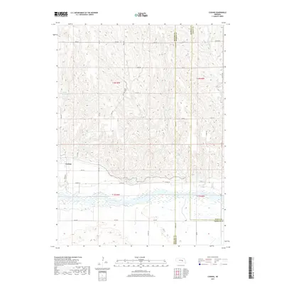
2017 Map of Cushing
USGS Topo · Published 2017About this map
Cushing sits at the intersection of Denton Rd and 18th Ave, marking a localized pocket of settlement within a landscape largely defined by the wide, braided course of the Loup River. This survey captures the rural character of Howard County, where the terrain transitions from the river valley to the north into rolling uplands dissected by waterways such as Rock Cr and Cottonwood Cr. These creeks dictate the historical placement of essential community landmarks, most notably the Rock Creek Cem located near the headwaters of its namesake stream.
Find a feature on this map
38 named features on this map. Tap any name to fly to it.
Don’t see what you’re looking for? This feature index may not catch every label — zoom into the map to look around manually.
Map Details
Editions of this 2017 Cushing Map
This is the sole edition of this map. No revisions or reprints were ever made.
Other maps of this area

1899 · St. Paul
USGS Topo · 1:125,000

1954 · Wolbach
USGS Topo · 1:24,000

1954 · Wolbach NE
USGS Topo · 1:24,000

1954 · Belgrade NW
USGS Topo · 1:24,000

1955 · Belgrade SW
USGS Topo · 1:24,000

1955 · Broken Bow
USGS Topo · 1:250,000

1955 · Wolbach SW
USGS Topo · 1:24,000

1955 · Cushing
USGS Topo · 1:24,000

1956 · Broken Bow
USGS Topo · 1:250,000
1960 · St. Paul
USGS Topo · 1:24,000